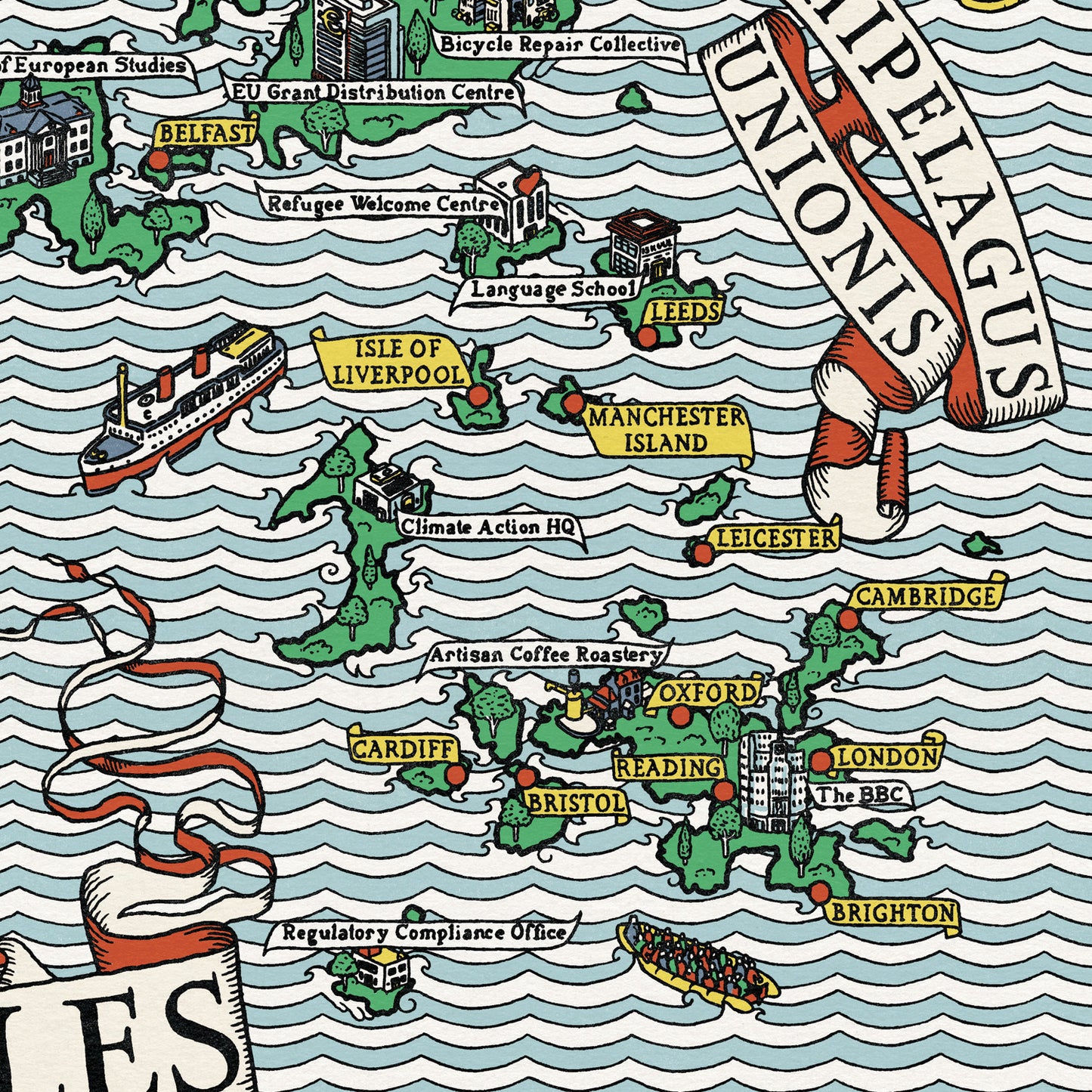
Created to mark the tenth anniversary of the Brexit referendum, A Map of the Brexit Isles imagines Britain as two neighbouring archipelagos: one Leave, one Remain. In the tradition of the great pictorial maps of the early twentieth century, every corner is packed with detail. The ‘Remain’ islands are home to Wind Farms, Refugee Welcome Centres, EU Grant Distribution Centres and the BBC; the ‘Leave’ islands boast cricket grounds, maypoles, the Office for Imperial Measures and the Museum of Imperial Glory. Familiar political arguments are recast as geography, and stereotypes become landmarks. Produced by J. G. Fox for ARC’s Brexit anniversary dinner, the map is intended as both a commemoration and a joke: a cheerful act of political cartooning on an unusually large scale.